
- HOME
- OPINION
- ON GROUND
- INTERVIEW
- Neta Profile
- Editor's Pick
- INDIA
- NewsGram USA
- WORLD
- न्यूजग्राम
- POLITICS
- ENTERTAINMENT
- CULTURE
- LIFESTYLE
- ECONOMY
- SPORTS
- Jobs / Internships
- Misc.
- NewsGram Exclusive
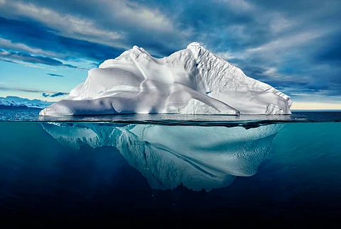
A team of scientists has mapped a huge, actively circulating groundwater system in deep sediments in West Antarctica.
The team at Columbia University estimated that if all of it were extracted, it would form a water column from 220 to 820 meters high -- at least 10 times more than in the shallow hydrologic systems within and at the base of the ice -- may be much more even than that.
However, they noted that said such systems, probably common in Antarctica, may have as-yet-unknown implications for how the frozen continent reacts to, or possibly even contributes to, climate change.
"People have hypothesized that there could be deep groundwater in these sediments, but up to now, no one has done any detailed imaging," said lead author Chloe Gustafson, who did the research as a graduate student at Columbia University's Lamont-Doherty Earth Observatory.
Scientists have, for decades, flown radars and other instruments over the Antarctic ice sheet to image subsurface features. Among many other things, these missions have revealed sedimentary basins sandwiched between ice and bedrock. But airborne geophysics can generally reveal only the rough outlines of such features, not water content or other characteristics.
In the research appearing in the journal Science, the team concentrated on the 60-mile-wide Whillans Ice Stream, one of a half-dozen fast-moving streams feeding the Ross Ice Shelf, the world's largest.
To better map the sediments and their properties, they used geophysical instruments placed directly on the surface.

Their analysis showed that, depending on location, the sediments extend below the base of the ice from a half kilometer to nearly two kilometers before hitting bedrock. And they confirmed that the sediments are loaded with liquid water down.
They were also able to show that the groundwater becomes more saline with depth.
However, the researchers said, if the ice surface were too thin -- a distinct possibility as the climate warms -- the direction of water flow could be reversed. Overlying pressures would decrease, and deeper groundwater could begin welling up toward the ice base. This could further lubricate the base of the ice and increase its forward motion.
Furthermore, if deep groundwater flows upward, it could carry up geothermal heat naturally generated in the bedrock; this could further thaw the base of the ice and propel it forward. But if that will happen, and to what extent, is not clear, the team said. (AA/IANS)
Subscribe to our channels on YouTube and WhatsApp
Download our app on Play Store