
- HOME
- OPINION
- ON GROUND
- INTERVIEW
- Neta Profile
- FIFA WORLD CUP 2026
- INDIA
- NewsGram USA
- WORLD
- न्यूजग्राम
- POLITICS
- ENTERTAINMENT
- CULTURE
- LIFESTYLE
- ECONOMY
- SPORTS
- Jobs / Internships
- Misc.
- NewsGram Exclusive

By Varsha Singh
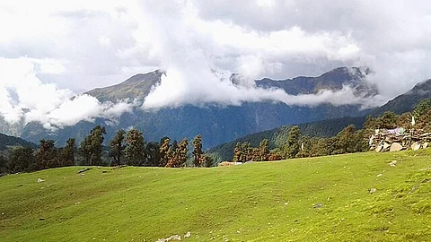
Chamoli & Gopeshwar, Uttarakhand: “We are from a land that is home to gods and goddesses. This is Devbhoomi (the land of the gods). But now the weather is changing. The glaciers are retreating. In our high Himalayan villages like Niti, Mana, and Malari, snowfall is no longer what it used to be. I went to my village Mana on December 8 last winter, and there was no snow to be seen,” says Pitambar Singh Molfa (63) head of Mana village in Uttarakhand’s Chamoli district.
Every winter, residents of these villages migrate to lower-altitude settlements, returning in April as summer begins. When this reporter met Molfa in the third week of April, he was packing up his winter home in Ghinghran, ready to return to Mana: a Bhotiya tribal settlement once called the last village of India and now rebranded the first, as beyond it lie only snow-covered Himalayan peaks.
Joshimath block, where Mana falls, is infamous for land subsidence, the gradual sinking of the ground caused by resource extraction, earthquakes, soil compaction, erosion, sinkholes, or the infusion of water into fine soils. It has shaken the ground beneath its 10,000-odd residents, leaving cracks in more than 600 homes and gaping holes in parts of the holy town.
See Also: Delhi CM Rekha Gupta Attacked During Weekly Jan Sunwai at Civil Lines Residence
For the Bhotiya community, which worships the Himalayan peaks as local gods, snowfall shapes livelihood, festivals, and faith. But that snow is disappearing. “After the monsoon, in October and November, there used to be continuous snowfall and rain for 72 hours. We call that snow syun. Ringal tonya, khark dhonya, which means snow so heavy it could snap bamboo-like ringal plants and clear resting points between glaciers. That snow no longer falls,” Molfa told 101Reporters.
His observations are echoed in the data. The Hindu Kush Himalayan region has recorded below-average snowfall for three consecutive years. In 2025, snowfall was 24% below normal, the lowest in 23 years. In the Ganga basin, snowfall that was 30% above average in 2015 has now dropped to nearly 24% below normal.
Sacred flowers like Brahmakamal, Neelkamal and Phen kamal are plucked only during Nanda Ashtami, when they are fully matured and offered to goddess Nanda Devi. “The Dronagiri mountain is considered her uncle,” Rawat smiles. “Our faith, our rules, they all helped protect the environment.”
Now, he said, both snow and gods are receding. “When we do not live in harmony with nature, she shows her wrath.”
That wrath is visible.
Rising temperatures and erratic snowfall are shrinking glaciers worldwide, increasing the risk of glacial lake outburst floods (GLOFs), debris flows, and rockfalls.
Uttarakhand alone has about 1,400 glaciers that feed the Ganga, Yamuna, and their tributaries, and more than 1,350 glacial lakes. Chamoli district has the most at 713.
One of them, Vasudhara Tal, was once a small waterbody at the confluence of the Raikana and East Kamet glaciers. As Raikana retreated rapidly, the lake expanded, from 0.14 square kilometres in 1968 to 0.59 square kilometres by 2021, becoming larger than Naini Lake. It now sits at 4,680 metres above sea level, 14 kilometres from the nearest road, held back only by a moraine, a natural wall of debris. If rising meltwater breaches it, a sudden flood could devastate the Dhauliganga valley and its hydroelectric projects.
The Wadia Institute of Himalayan Geology and the Uttarakhand State Disaster Management Authority are monitoring 13 high-risk glacial lakes across the state. At Vasudhara Tal, scientists have mapped the lake bed to calculate how much water could surge downstream if the moraine fails. They recommend banning construction within 200 metres of riverbanks in downstream villages such as Goting, Niti, Gamsali, Kailashpur, and Malari, alongside building early warning systems.
See Also: Ozempic and other weight-loss drugs linked to rare but serious eye conditions
And recent history has offered grim warnings for the region.
In 2021, an avalanche in Chamoli’s Nanda Devi range caused a flood that destroyed two hydropower projects. In October 2023, the breach of South Lhonak Lake in Sikkim killed at least 55 people, swept away the Teesta-III dam, and washed out bridges and roads. Similar GLOFs have struck Nepal, Thame in 2024, Rasuwa in July 2025, leaving trails of death and destruction.
In Ghinghran village, tin roofs rattled under rain mixed with hail during this reporter’s April visit, and it poured almost daily. As she packed household items, Gayatri Devi, wife of village head Molfa, said, “When sudden, intense rain starts in Mana, we fear something bad will happen. Sometimes heavy rain dislodges chunks of the glacier. But whatever happens, we will not leave.”
Molfa pointed out that rainfall alerts, sent as SMS in English, often go untranslated. “These should be in the local language,” he said, stressing the need for safe community shelters stocked with ropes, stretchers, first-aid kits and mountaineering gear. He added that disaster readiness should extend across nearby villages, with trained volunteers on standby.
One such volunteer is Vijay Butola (30) of Lata, a trekker trained in Himalayan search and rescue by the Nehru Institute of Mountaineering. He has taken multiple training courses and learnt skills like rope work to avalanche rescues. All of it is self-funded; neither the government nor the local administration provided him any training, he said.
In the 2021 floods, when the Rishiganga bridge collapsed and Raini was cut off, Butola and the State Disaster Response Force built a 150-metre zipline to move rescuers and supplies. The next night, he helped mark a makeshift helipad for air evacuations. For nearly a month, he stayed in the field.
Butola’s village, Lata, sits high above the Dhauli Ganga, its steep approach leaving visitors breathless. In February 2021, this river had turned violent alongside the Rishiganga. At its source, the Raikana glacier, Vasudhara Tal is quietly expanding. Yet even informed locals like Molfa and Butola had never heard of the lake, naming only well-known ones like Satopanth and Roopkund. In this landscape, knowledge about the most immediate risks remains patchy, even among those most likely to face them.
The Himalayan glaciers, often called the “third pole,” sustain nearly two billion people across the Asia-Pacific region. Yet on a global scale, they remain overlooked. A recent UNESCO report stresses that understanding glacier changes and making effective policies requires collaboration between scientists and local communities.
Bhutan offers an example of such collaboration. There, residents have been trained to monitor glacial lakes, measuring water levels, discharge, and depth, enabling them to predict how far downstream the impact might reach if a lake bursts. Villages at risk are warned well in advance. Glaciologist Dr DP Dobhal, who had cautioned about Chorabari Lake before it intensified the 2013 Kedarnath disaster, said: “We must develop monitoring and early warning systems for glacial lakes. But local people shouldn’t just receive warnings, they should be part of the system.”
The central government’s “Mission Mausam” (2024–2026) aims to do just that, using modern technology to build early warning systems for GLOFs. In Uttarakhand, five glacial lakes, including Vasudhara Tal, have been identified as potentially hazardous. State Disaster Management Secretary Vinod Kumar Suman says sensors will be installed in at-risk lakes, linked to sirens in nearby villages. “If a disaster strikes, we want people to know the evacuation routes and safe shelters,” he added.
Notably, after the 2021 disaster, water gauges were placed along the Rishi Ganga and Dhauli Ganga rivers to trigger sirens if water levels rise sharply. One such system stands opposite Reni, the village worst-hit in 2021. “If an avalanche threatens to raise the river level, the siren will sound,” says Rami Devi (35), an Anganwadi worker, though it has yet to be triggered. Similar systems near Lata village have also remained silent.
Much about Vasudhara Tal remains unknown. “Remote sensing can map a lake’s surface area, but not its depth,” said geoscientist Dr Navin Juyal, formerly with the Physical Research Laboratory, Department of Space. “Without depth data, we cannot calculate water volume, and without volume, we cannot assess hazard levels.” He added that hydrodynamic studies are essential to model how water would behave if the lake were hit by an avalanche: the direction and speed of the flow, whether the lake is ice-covered or debris-filled, how far the flood would reach, and which settlements would be at risk.
This article is republished from 101Reporters under a Creative Commons license. Read the original article.
(101Reporter/NS)
Also Read:
Subscribe to our channels on YouTube and WhatsApp
Download our app on Play Store